Select variation:
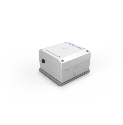
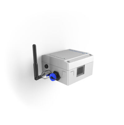
GNSS Meter
Worldsensing’s GNSS Meter is a wireless sensor designed for high-precision, automated measurement of surface point movements. It features advanced multi-band Real-Time Kinematic (RTK) technology and innovative edge processing that delivers millimetric precision with great reliability.
Download Materials
Product information:
Key Features
- Achieves sub-centimeter precision (down to 2mm) with hourly position updates, offering two aggregation levels: 6h and 24h.
- Flexible configuration: operates seamlessly as both a base and rover, with field tools for radio link testing
- Advanced edge data processing allows position quality and system performance statistics transmitted via radio and available in CMT
- Battery-powered with D-size batteries, providing over 3 years of autonomy
- Integrated tiltmeter and environmental sensors measure vertical shifts in structures and provide data when RTK conditions are unavailable
Applications
- Track 3D ground movements in structures, foundations, and infrastructure
- Monitor 3D ground movements, such as coastal subsidence or shifts caused by swelling rocks and expansive soils
- Monitor landslides, open pits, and unstable slopes
Technical Specifications
- Sensor type: GNSS
- Secondary Sensor: Tiltmeter
- Environmental Sensor: Integrated temperature and humidity sensor
- Power source: 4 x 3,6 V D-size user-replaceable, high energy density batteries
- Reporting Period: 1 h
- Communications: LoRa radio (ISM sub GHz)
- GNSS time synchronization: ±1s
- Reporting Format: Position (WGS84) data for
- Last hour sample
- Last 6 h aggregated
- Last 24 h aggregated
- System configuration: Device setup and configuration via Worldsensing App. Remote configuration using CMT Edge. Data can be exported to third-party software via MQTT, REST API, or FTP.
GNSS Sensor
- Correction Technology: Real time Kinematic (RTK)
- GNSS Channels: 184
- Constellations/ GNSS Signals received:
- GPS / QZSS: L1C/A, L2
- GLONASS: L1OF, L2OF
- Galileo: E1-B/C, E5b
- BeiDou: B1I, B2I
- GNSS warmup time: Selectable from 10 s, 20 s, 30 s
Tiltmeter
- Sensor type: 3-axis MEMS accelerometer
- Range: ±90º
- Accuracy:
- ± 2º: ± 0.0025º
- ± 15º: ± 0.013º
- ± 80º: ± 0.23º
- Offset temperature dependency: ± 0.002°/°C
GNSS Precision 95th Percentile
| Distance base to rover | 1 h last sample | 6 h aggregated | 24 h aggregated |
| 40 m Horizontal | 9 mm | 3 mm | 2 mm |
| 40 m Vertical | 20 mm | 5 mm | 3 mm |
| 4 000 m Horizontal | 21 mm | 8 mm | 4 mm |
| 4000 m Vertical | 31 mm | 15 mm | 7 mm |
Battery life estimations
| Warmup time | 10 s | 20 s | 30 s |
| Base | 3.1 years | 2.7 years | 2.4 years |
| Rover | 3.5 years | 2.9 years | 2.5 years |
Related products
Laser Tiltmeter
The Worldsensing Laser Tiltmeter is a 3-in-1 device combining laser distance meter, inclinometer and data…
Vibration Meter
The Worldsensing Vibration Meter is a wireless 3-axis MEMS accelerometer designed for continuous, long-term vibration…
Tiltmeter Event Detection
The Worldsensing Tiltmeter Event Detection is a smart, 3-axis wireless tiltmeter designed to identify ground…